A great Half and a great day today! I got to indulge in two of my favorite things: running and history.
The race started at 8:05 am so we were up early to catch the shuttle to the start. One word can describe this morning as I waited to start this race: COLD. It peeked at 32 F around 7:30 am. But, I like cool temps for running so I knew this would work once I got moving.
The route was fantastic. It went through downtown Shepherdstown, through the C & O Canal, and then into Sharpsburg, Maryland (both historical Civil War towns) towards Antietam Battlefield. I took one picture below to show the hills of the battlefield on this crisp, sunny morning. It was great. I fought the temptation to stop every five minutes and take pictures as I knew I'd be returning after the race to take a little tour. But, this route which took me through such a significant part of our history was certainly a first in my 50 state challenge.
This was definitely a hilly race. We're not talking the killer hills of Fairfield (Connecticut Half) but it certainly presented a challenge. As I state above, running through Antietam was where I encountered the bulk of the hills and that was after a nice half mile stretch starting at just around mile three. That's when I knew this was going to be a little tough. My Plantars never bothered me once which is good. However, as per the norm, it's a bit tender a few hours later and will require a little bit of stretching before calling it a day tonight.
I finished in 1:45:43 with a pace of 8:04 and placed 22nd in my age group (30-39) I know I'll do better next time but I'm happy with this time.
After the race Carla and I headed back downtown to get some breakfast at Betty's before heading over to the Antietam Visitor Center to take a tour. I'll let the pictures below do the talking. Every picture I took tells a story of the battle that day. I could be here typing all day about each picture but just know that everywhere you looked pretty much tells a story of a battle or turning point that day. One story in particular that caught my attention was that of The Sunken Road. The soldiers would later call it "
Bloody Lane."
Up next is New Hampshire in three weeks on November 4. I'll update as we get closer. Should be nice as I've never been to New Hampshire.
Enjoy ...
.JPG) |
| Walking to the start |
.JPG) |
| Staging area and finish. |
.JPG) |
| Heading to the start line |
.JPG) |
| I just liked the colors on this tree. |
.JPG) |
| This was helpful in leading us to the start line. |
.JPG) |
| Running through the hills of Antietam Battlefield. |
.JPG) |
| Finish line. |
.JPG) |
| Time for breakfast at Betty's |
.JPG) |
| Just a little tired. |
.JPG) |
| One for the Confederates. |
.JPG) |
| One for the Union. |
.JPG) |
| Heading to The Sunken Road, also known as "Bloody Lane" |
.JPG) |
| "Bloody Lane" (this pic is the after. See here for the before) |
.JPG) |
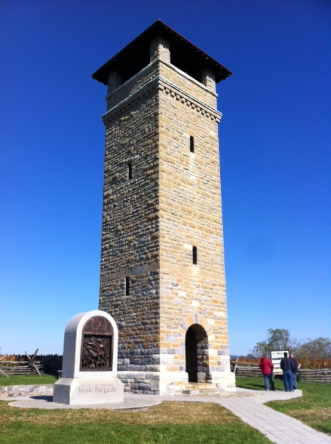
| War Observation Tower built in 1862 |
.JPG) |
| Heading home. |

.JPG)
.JPG)
.JPG)
.JPG)
.JPG)
.JPG)
.JPG)
.JPG)
.JPG)
.JPG)
.JPG)
.JPG)
.JPG)
.JPG)
.JPG)
.JPG)
.JPG)
.JPG)
.JPG)
.JPG)
.JPG)
.JPG)
.JPG)
.JPG)
.JPG)
.JPG)
.JPG)
.JPG)
.JPG)
.JPG)
.JPG)
.JPG)
.JPG)
.JPG)
Love the large photo, Berto! Looks great!! Where is a picture of your medal?
ReplyDeleteThank you for your comment, little buddy! The medal shot is the 13th photo down!
Delete